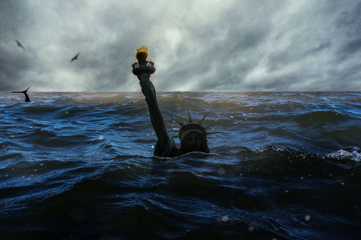
A look at the progress so far as another storm looms
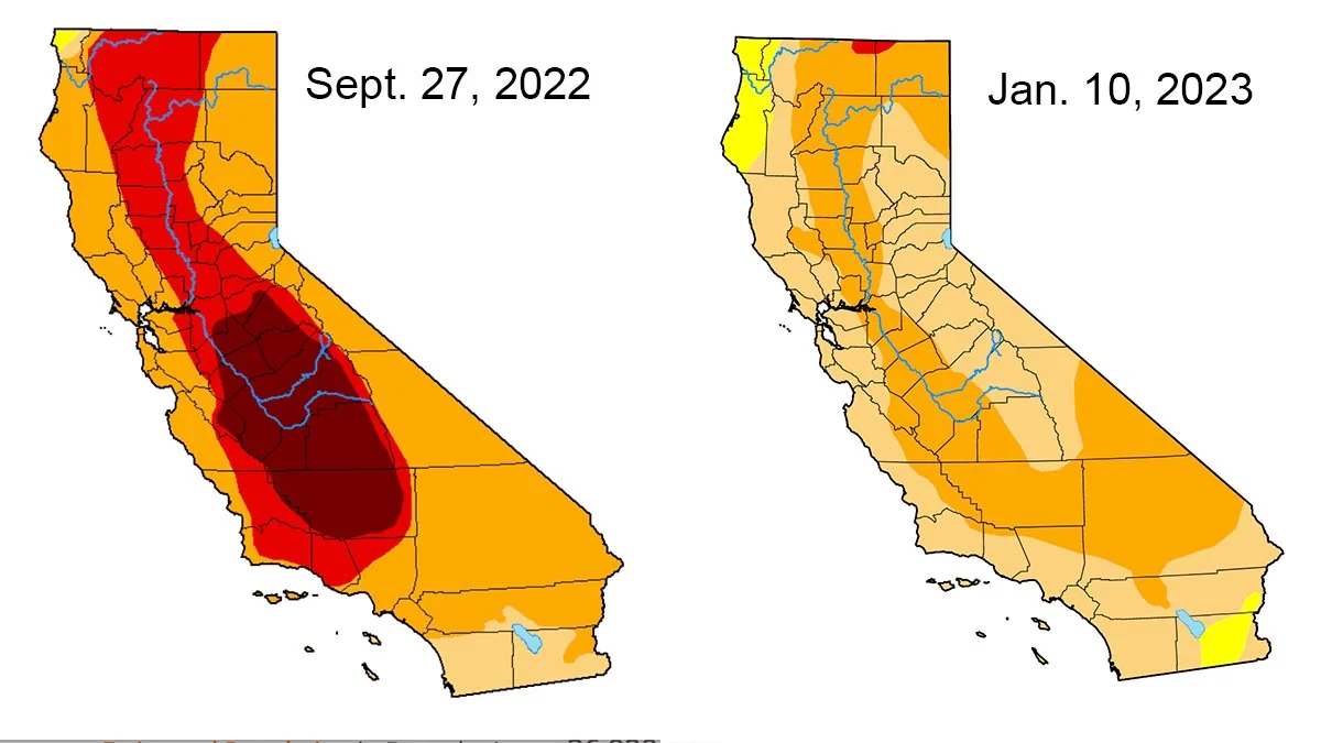
California has been some form of drought condition for most of the time since 2008. By September 2022 there were severe drought conditions in nearly all of the state. This was exacerbated by the driest first three months of any year at the beginning of 2022. Although December 2021 had precipitation and the snow pack was improved somewhat, it was not enough and this led to the extreme drought conditions by fall 2022.
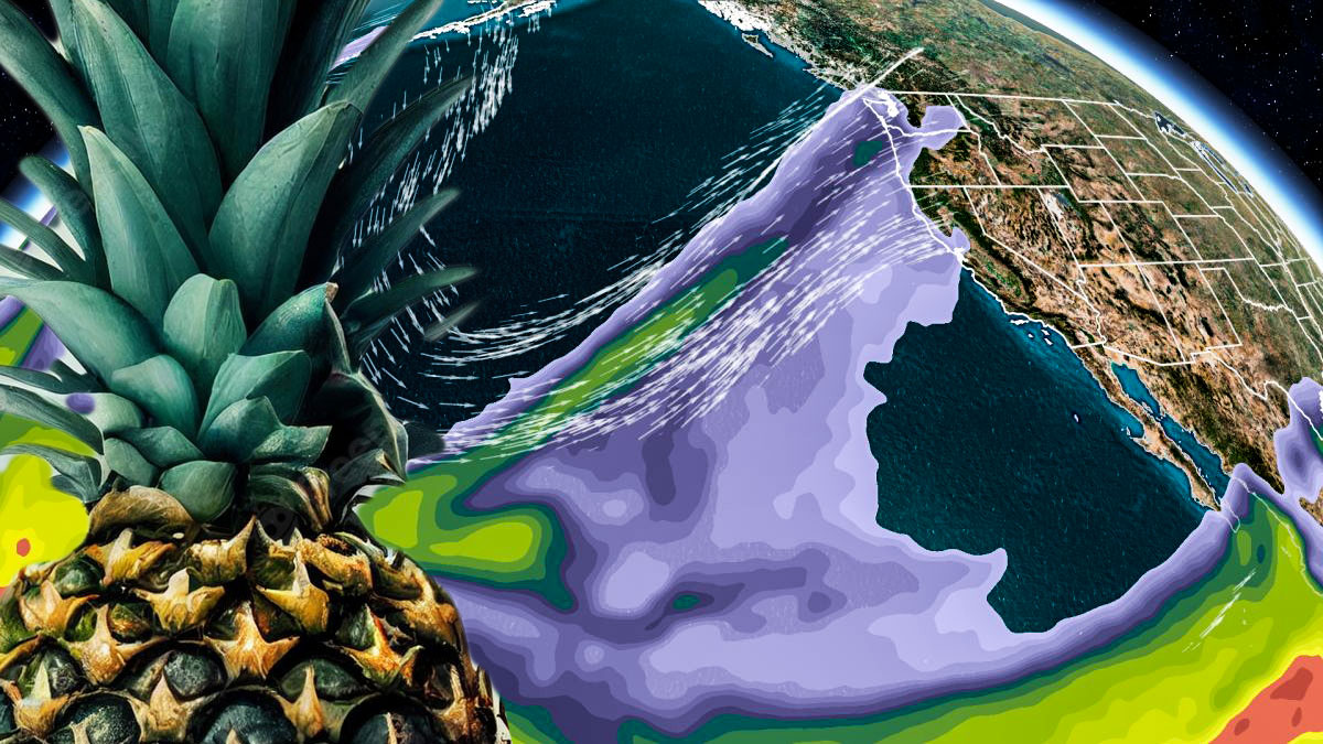
Atmospheric Rivers are a dangerous threat, but also bring large amounts of moisture
Another storm front of this type is expected for the weekend, and, while most of us have had more than enough of the floods and generally wet nasty conditions, the chances for improving the historic drought extremes have increased and we can continue to benefit.
The atmospheric rivers that we’ve seen in near continuous succession have brought a significant amount of rain, snow and moisture, making this one of the wettest winters in the record books.
It has, unfortunately, also been a destructive and deadly series of storms and there is still a danger that that aspect of the phenomenon will continue as well.
The US Drought Monitor has data on the situation continuously compiled, and as can be seen in the maps above there has been some meaningful improvement in the severity of the drought conditions. In particular, the worst areas have been brought back from the most extreme designation toward a somewhat more moderate state.
Much of the water that flows throughout California has melting snow, mostly from the Sierra Nevada Mountains, as its source. In the best case, abundant snow fall during the winter, which creates a kind of natural reservoir, is released during the warmer weather in spring and early summer.
With a large storm this weekend, and perhaps at least one more wet episode before the seasons change, the snow pack could reach “above normal” levels, which would be a big help to the still dry condition in the state. It is even possible that the storms could help fuel a spectacular super bloom, like we had in 2019
DROUGHT UPDATE: The continuous storms have improved our drought conditions! California is no longer under EXTREME or EXCEPTIONAL drought. Look at where we were at the start of the water year. More rain on the way through next week. @nbcla#drought#Californiapic.twitter.com/Q4lwIZV7tf
Seemingly endless atmospheric river systems reduce drought conditions and could have other benefits
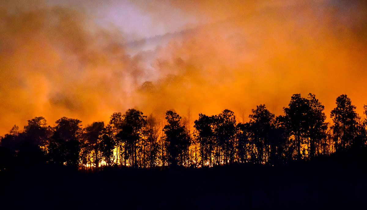
The West Coast is not a fan of extreme rain events, such as the recent atmospheric river conditions, that are so rare in the region. Floods, snarl ups on the freeways, potential landslides, and conditions that can lead to wildfires later in the year, are all unwelcome repercussions.
Fortunately, along with the mainly negative fallout, there’s also a silver lining of sorts, lurking beneath.
Although the extreme drought conditions have only been partially mitigated, less extreme conditions are far better to have than ever worsening ones.
A silver lining without an obvious caveat is the potential for a Superbloom, that could happen again this Spring, mainly in the desert areas of Southern California.
A Superbloom is a term used to describe a rare and beautiful occurrence in which various wildflowers bloom simultaneously in one location. These occurrences are frequently brought on by a number of elements, such as a lot of rain, warm weather, and the presence of specific plant species.
Awe-inspiring superblooms blanket hillsides and fields in a dazzling variety of hues and patterns. They contribute significantly to the ecosystem by giving a range of animals and insects food and a place to live.
Scientifically, superblooms provide an opportunity for researchers to study the factors that contribute to their formation and the effects they have on the ecosystem.
For example, the recent superbloom in California in 2019 was triggered by a combination of heavy rainfall and mild temperatures, leading to a proliferation of wildflowers in the state’s grasslands and chaparral regions.
Scientists can use this information to better understand the conditions that are required for superblooms to occur and impacts they have on the environment. This can be useful for predicting future superblooms as well as for conserving and protecting natural habitats.
Early in the 20th century, California had the first superbloom, which was characterized by a profusion of wildflowers in the state’s green and desert areas as a result of several wet winters and mild springs.
Since then, superblooms have seemingly become a regular occurrence in California, with the most recent one occurring in 2019.
However, superblooms are not exclusive to California. They have also been observed in other parts of the United States, including Nevada, Arizona, and Texas, as well as in countries such as Australia, South Africa, and Israel.
While superblooms are a natural and beautiful phenomenon, they can also sometimes be a source of conflict. In recent years, the popularity of superblooms has led to an increase in tourism to the areas where they occur, causing overcrowding and damage to the environment.
To address these issues, some local governments have implemented measures to manage the large influx of visitors, such as limiting the number of people allowed to roam in certain areas or establishing designated viewing areas.
In addition to their potential for environmental and tourism impacts, Superblooms also have cultural significance.
For indigenous communities, Superblooms can have spiritual significance. In some cases, wildflowers are used in traditional medicine and rituals, and the presence of a Superbloom may be seen as a sign of good fortune or a blessing.
For example, the Native American Kumeyaay tribe in California the arrival of a Superbloom may be seen as a time of renewal and celebration.
Even with the potential for various issues and controversies, a Superbloom for the Spring of 2023 would be a welcome silver lining to help us all by propagating beauty, even as the outcome of stormy weather.
Drought that looked invincible has met extreme opposite weather: stalemate?
Atmospheric river storms can actually be welcome in California during a historic drought, like the one this year. In some cases, nearly 50% of California’s precipitation each year can be the result of atmospheric rivers, and they can bring enough water to stop even a historic drought in its tracks.
Atmospheric river storms, also known as “pineapple express” storms, have sometimes been known to bring much-needed rain and snow to drought-stricken areas, including California.
Extreme weather, wildfires, and more have been on the increase worldwide as a result of global warming and climate change.
Atmospheric river storms are characterized by a narrow corridor of strong winds and heavy precipitation that can extend for thousands of miles. They are often associated with the transport of moist air from tropical regions, and they can be a significant source of water for many areas.
In California, atmospheric river storms can provide a much-needed source of water for agriculture, hydroelectric power generation, and other important water-dependent activities.
They can also help to replenish reservoirs and groundwater aquifers, which can help to mitigate the impacts of drought.
The monumental drought of 2022 in the rearview?
Just as it was looking as if there was zero chance for enough moisture to reverse the long, intense drought conditions that California has suffered this year, the “Pineapple Express” became a holiday storm front. There is a sense of relief, although it is too early to tell if the drought will end as a result of this rain.
It is also important to note that these storms can also bring heavy rainfall and strong winds, which can lead to flooding and other hazards. As a result, it is important for people in affected areas to be prepared and take necessary precautions.
An atmospheric river is a narrow band of moisture-rich air that extends from the tropics or subtropics to higher latitudes. These rivers of air are typically about a thousand miles wide and several thousand miles long, and they can transport enormous amounts of water vapor from the tropics to other parts of the world.
Atmospheric rivers are important because they play a crucial role in the global water cycle.
Water evaporates from the surface of the ocean, rises into the atmosphere, and then condenses to form clouds. As the clouds move over land, they release their moisture in the form of rain or snow.
Atmospheric rivers are responsible for a large portion of the moisture that falls as precipitation in many parts of the world, particularly along the western coasts of the United States, Europe, and Asia.
Atmospheric rivers can be either warm or cold, depending on the temperature of the air that they are carrying.
Warm atmospheric rivers are typically associated with heavy rainfall and floods, while cold atmospheric rivers can bring snow and ice to colder regions.
One of the most well-known atmospheric rivers is the “Pineapple Express,” which is a warm atmospheric river that brings moist air from the tropics to the Pacific Northwest of the United States.
The Pineapple Express is named after the tropical fruit because it brings warm, tropical air to the region. This atmospheric river is responsible for a large portion of the precipitation that falls in the Pacific Northwest, and it can cause heavy rainfall and floods in the region.
Another well-known atmospheric river is the “North Atlantic Oscillation,” which is a cold atmospheric river that brings moist air from the subtropics to the northeastern United States and eastern Canada.
This atmospheric river is responsible for a large portion of the snowfall that falls in these regions, and it can cause heavy snow and ice storms.
Atmospheric rivers can have a significant impact on the weather and climate of the regions that they affect.
They can bring much-needed moisture to dry regions, which can help to alleviate drought conditions. However, they can also cause heavy rainfall and floods, which can lead to damage to infrastructure and loss of life.
In recent years, there has been an increasing awareness of the importance of atmospheric rivers and their potential impact on the global water cycle.
Scientists are working to better understand atmospheric rivers and to develop better tools for predicting and managing their effects.
This research is important because atmospheric rivers are likely to become more intense and more frequent in the future due to climate change.
Generally speaking, an atmospheric river is a narrow band of moisture-rich air that extends from the tropics or subtropics to higher latitudes.
These rivers of air play a crucial role in the global water cycle and can bring much-needed moisture to dry regions or cause heavy rainfall and floods.
There is an increasing awareness of the importance of atmospheric rivers and their potential impact on the global water cycle, and scientists are working to better understand and predict their effects.
“Climate change is here and now,” said Rep. Pramila Jayapal. “If a 1,200 year mega-drought isn’t enough to make people realize that, I don’t know what is.”
The megadrought which has gripped western U.S. states including California and Arizona over the past two decades has been made substantially worse by the human-caused climate crisis, new research shows, resulting in the region’s driest period in about 1,200 years.
Scientists at University of California-Los Angeles, NASA, and Columbia University found that extreme heat and dryness in the West over the past two years have pushed the drought that began in 2000 past the conditions seen during a megadrought in the late 1500s.
“We’re sort of shifting into basically unprecedented times relative to anything we’ve seen in the last several hundred years.”
The authors of the new study, which was published Monday in the journal Nature Climate Change, followed up on research they had conducted in 2020, when they found the current drought was the second-worst on record in the region after the one that lasted for several years in the 16th century.
Since that study was published, the American West has seen a heatwave so extreme it sparked dozens of wildfires and killed hundreds of people and droughtconditions which affected more than 90% of the area as of last summer, pushing the region’s conditions past “that extreme mark,” according to the Los Angeles Times.
The scientists examined wood cores extracted from thousands of trees at about 1,600 sites across the West, using the data from growth rings in ancient trees to determine soil moisture levels going back to the 800s.
They then compared current conditions to seven other megadroughts—which are defined as droughts that are both severe and generally last a number of decades—that happened between the 800s and 1500s.
The researchers estimated that the extreme dry conditions facing tens of millions of people across the western U.S. have been made about 42% more severe by the climate crisis being driven by fossil fuel extraction and emissions.
“The results are really concerning, because it’s showing that the drought conditions we are facing now are substantially worse because of climate change,” Park Williams, a climate scientist at UCLA and the study’s lead author, told the Los Angeles Times.
In the region Williams and his colleagues examined, the average temperature since the drought began in 2000 was 1.6° Fahrenheit warmer than the average in the previous 50 years. Without the climate crisis driving global temperatures up, the West would still have faced drought conditions, but based on climate models studied by the researchers, there would have been a reprieve from the drought in 2005 and 2006.
“Without climate change, the past 22 years would have probably still been the driest period in 300 years,” Williams said in a statement. “But it wouldn’t be holding a candle to the megadroughts of the 1500s, 1200s, or 1100s.”
Rep. Pramila Jayapal (D-Wash.) said the new research must push the U.S. Congress to take far-reaching action to mitigate the climate crisis, as legislation containing measures to shift away from fossil fuel extraction and toward renewable energy is stalled largely due to objections from Republicans and right-wing Democratic Sen. Joe Manchin of West Virginia.
“It’s time for Congress to act by making meaningful investments into climate action—before it’s too late,” she said.
Climate change is here and now.
If a 1,200 year mega-drought isn't enough to make people realize that, I don't know what is. It's time for Congress to act by making meaningful investments into climate action — before it's too late.https://t.co/jExzMKUXxr
The drought has had a variety of effects on the West, including declining water supplies in the largest reservoirs of the Colorado River—Lake Mead and Lake Powell— as well as reservoirs across California and the Great Salt Lake in Utah.
According to the U.S. Drought Monitor, 96% of the Western U.S. is now “abnormally dry” and 88% of the region is in a drought.
“We’re experiencing this variability now within this long-term aridification due to anthropogenic climate change, which is going to make the events more severe,” Isla Simpson, a climate scientist at the National Center for Atmospheric Research who was not involved in the study released Monday, told the Los Angeles Times.
The researchers also created simulations of other droughts they examined between 800 and 1500, superimposing the same amount of drying driven by climate change. In 94% of the simulations, the drought persisted for at least 23 years, and in 75% of the simulations, it lasted for at least three decades—suggesting that the current drought will continue for a number of years.
Williams said it is “extremely unlikely that this drought can be ended in one wet year.”
“We’re sort of shifting into basically unprecedented times relative to anything we’ve seen in the last several hundred years,” Samantha Stevenson, a climate modeler at the University of California, Santa Barbara who was not involved in the study, told the New York Times.
Originally published on Common Dreams by JULIA CONLEY and republished under a Creative Commons (CC BY-NC-ND 3.0) license
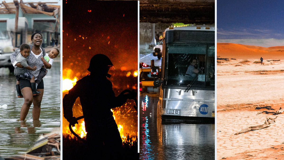
New Orleans, Lake Tahoe, NYC – that’s just this week and just in the US… and a drought in the west that is a serious growing threat
The warnings are coming hard and heavy after multiple previous and eerily similar catastrophes, only they just keep getting more severe. Each one is a unique event and each has a litany and list of records that smash all prior statistics since record keeping began.
“Hottest month ever”, “most rainfall in an hour ever recorded”, “worst flood in NY history”, these hyperbolic sounding statements are not hyperbole at all, just facts, but since they are becoming a nearly constant refrain, the entire situation appears surreal.
Journalists use words like “dystopian” and twitter users compare photos and general panic to the climate disaster movie “The Day After Tomorrow” and note that the current reality is already scarier than what the movie was able to convey.
Underneath the shock is a layer of manufactured apathy
Even as the signs of an expanding and accelerating worldwide disaster are more obvious, season by season, month by month and even day by day, there is, nevertheless, a kind of paralysis surrounding the fear.
Fossil fuel subsidies continue to be handed out, so many half-measures and excuses are bandied about, and personal, individual responsibility is used as a bludgeon to guilt the populous into a state of inaction.
It’s called a climate emergency because it is an emergency, so act like it, to paraphrase Greta Thunberg. Unfortunately, dire emergencies are not scarce at the moment, and the situation is likely to get worse, meanwhile it is a valid question; what would be done if the climate crisis were actually treated like an emergency?
New York Floods, Ida aftermath, September 2021
Above: Photo: Lyxotic / Adobe Stock
The remnants of Hurricane Ida resulted in extreme dumping of historic levels of rainfall, with Central Park in N.Y.C. receiving 3.15 inches of rain in just one hour. Newark Airport was shut down and many flooded streets in the five boroughs and surrounding areas of New Jersey and Pennsylvania were transformed into virtual rivers. Subway entrances and basement dwellings quickly filled until they overflowed.
The national Weather Service issued its first ever “flash flood emergency” for the area as well as both NY and NJ leaders issuing states of emergency.
The death toll quickly rose to at least 50 people. Reports of those that were killed mostly died as a result of being flooded in basement living spaces or overtaken by water both inside and outside their vehicles.
The Climate Crisis is not a movie and a majority has to demand action of Government and Industry: the individual is not to blame
In a way the problem inherently contains the seeds to its own resolution. The current state of climate emergency could have been partially averted, or at least slowed down, had government and, in particular, the fossil fuel industrial complex done more than talk and come up with tricks like greenwashing and propaganda to distract and delay the obvious need to stop carbon (CO2) pollution. The signs were evident for many decades, and some alternative solutions were known for over a century, while the fossil fuel behemoth just kept expanding.
Now, with the crisis getting more extreme and deadly, seemingly by the hour, it will take an equally extreme change in the response – a literal washing away of the status quo that created the problem. That may look like a system wide collapse, bringing down the structure that props up the suicidal stupidity of the current system, or something equally extreme, if real solutions are to have time to have any chance of having an impact.
Hurricane Ida made landfall as a Category 4 Sunday morning (August 30, 2021) also marking the 16th anniversary of Hurricane Katrina. Ida had maximum sustained winds of 150 mph, just shy of making it a Category 5 (winds greater than 155 mph). Radar approximates that up to about 17 inches of rainfall were recorded just west of New Orleans.
Over a million customers lost power in Louisiana, making it the 2nd largest power outage in the state since 2000. The outage could leave residents without power for up to six weeks, rendering them helpless for electricity during increasingly hot late summer weather. Numerous streets need power lines raised that were brought down or snapped by Ida’s winds.
Cantrell, the New Orleans major spoke of voluntary evacuations, particularly for residents that have special needs, seniors or those vulnerable to the heat.
Extreme weather, ocean temps, rising sea levels with melting ice caps, all connected and all increasingly menacing
It has appeared, unfortunately, for nearly decades as if the predictions of ocean temperature increase and sea level rise would have to continue until multiple major cities are fully submerged before any real steps would begin to combat the causes.
Is that still the case after the four “disaster stories” this week? Was the tragedy and destruction enough to have people begin to actually realize that there are no decades left to “wait and see”?
Caldor / Lake Tahoe Fire
The Caldor Fire has burned around 213,270 acres covering 2 California counties (El Dorado and Amador) and currently only 32% contained (as of September 3rd). The fires have been active for 19 days according to Cal Fire. Thousands of people have been forced to evacuate. The looming threat of the fires reaching the popular tourist location of South Lake Tahoe are safe for now, however, and flames have been averted.
The fire created widespread haze and smoke, resulting in extremely hazardous air quality.
The total number of structures destroyed by the fire is 857 as of Sept 3rd, marking it as the 20th most destructive fire in recorded history for California.
Water levels from the largest reservoir on the Colorado River and Lake Mead, which supply drinking and irrigation water to Colorado, Nevada, Arizona, California and Mexico have reached record low levels.
Regulators now have to make crucial steps to protect another crucial water source, the Sacramento-San Joaquin Delta, the water system that helps to provide 2/3 of CA population, irrigation for agricultural industry as well as state’s norther border with Oregon.
California residents could be facing future water restriction, however according to Gov. Gavin Newsom it is not likely to be in force until the end of September (the delay could be his attempt to avoid any unpopular mandates before the Sept 14. Recall Election).
Some drastic measures have been taken so far at National State parks in order to help conserve water including closing bathrooms and showers and shutting off water faucets/fountains.
Four stories just from this week: is this a turning point and a wake up call that we desperately need?
Does New York City, or Miami, or Mumbai have to be permanently flooded or fully submerged before we “notice” and demand action? Or, is now the time to mark the date – September 2021 as the moment that the climate emergency was finally “real”? Will it be seen, understood as imminent, and acted on as an emergency of the magnitude that it already is?
One of the country’s most important sources of fresh water is in peril, the latest victim of the accelerating climate crisis.
On a 110-degree day several years ago, surrounded by piles of sand and rock in the desert outside of Las Vegas, I stepped into a yellow cage large enough to fit three standing adults and was lowered 600 feet through a black hole into the ground. There, at the bottom, amid pooling water and dripping rock, was an enormous machine driving a cone-shaped drill bit into the earth. The machine was carving a cavernous, 3-mile tunnel beneath the bottom of the nation’s largest freshwater reservoir, Lake Mead.
Lake Mead, a reservoir formed by the construction of the Hoover Dam in the 1930s, is one of the most important pieces of infrastructure on the Colorado River, supplying fresh water to Nevada, California, Arizona and Mexico. The reservoir hasn’t been full since 1983. In 2000, it began a steady decline caused by epochal drought. On my visit in 2015, the lake was just about 40% full. A chalky ring on the surrounding cliffs marked where the waterline once reached, like the residue on an empty bathtub. The tunnel far below represented Nevada’s latest salvo in a simmering water war: the construction of a $1.4 billion drainage hole to ensure that if the lake ever ran dry, Las Vegas could get the very last drop.
For years, experts in the American West have predicted that, unless the steady overuse of water was brought under control, the Colorado River would no longer be able to support all of the 40 million people who depend on it. Over the past two decades, Western states took incremental steps to save water, signed agreements to share what was left and then, like Las Vegas, did what they could to protect themselves. But they believed the tipping point was still a long way off.
Like the record-breaking heat waves and the ceaseless mega-fires, the decline of the Colorado River has been faster than expected. This year, even though rainfall and snowpack high up in the Rocky Mountains were at near-normal levels, the parched soils and plants stricken by intense heat absorbed much of the water, and inflows to Lake Powell were around one-fourth of their usual amount. The Colorado’s flow has already declined by nearly 20%, on average, from its flow throughout the 1900s, and if the current rate of warming continues, the loss could well be 50% by the end of this century.
Earlier this month, federal officials declared an emergency water shortage on the Colorado River for the first time. The shortage declaration forces reductions in water deliveries to specific states, beginning with the abrupt cutoff of nearly one-fifth of Arizona’s supply from the river, and modest cuts for Nevada and Mexico, with more negotiations and cuts to follow. But it also sounded an alarm: one of the country’s most important sources of fresh water is in peril, another victim of the accelerating climate crisis.
Americans are about to face all sorts of difficult choices about how and where to live as the climate continues to heat up. States will be forced to choose which coastlines to abandon as sea levels rise, which wildfire-prone suburbs to retreat from and which small towns cannot afford new infrastructure to protect against floods or heat. What to do in the parts of the country that are losing their essential supply of water may turn out to be the first among those choices.
The Colorado River’s enormous significance extends well beyond the American West. In addition to providing water for the people of seven states, 29 federally recognized tribes and northern Mexico, its water is used to grow everything from the carrots stacked on supermarket shelves in New Jersey to the beef in a hamburger served at a Massachusetts diner. The power generated by its two biggest dams — the Hoover and Glen Canyon — is marketed across an electricity grid that reaches from Arizona to Wyoming.
The formal declaration of the water crisis arrived days after the Census Bureau released numbers showing that, even as the drought worsened over recent decades, hundreds of thousands more people have moved to the regions that depend on the Colorado.
Phoenix expanded more over the past 10 years than any other large American city, while smaller urban areas across Arizona, Nevada, Utah and California each ranked among the fastest-growing places in the country. The river’s water supports roughly 15 million more people today than it did when Bill Clinton was elected president in 1992. These statistics suggest that the climate crisis and explosive development in the West are on a collision course. And it raises the question: What happens next?
Since about 70% of water delivered from the Colorado River goes to growing crops, not to people in cities, the next step will likely be to demand large-scale reductions for farmers and ranchers across millions of acres of land, forcing wrenching choices about which crops to grow and for whom — an omen that many of America’s food-generating regions might ultimately have to shift someplace else as the climate warms.
California, so far shielded from major cuts, has already agreed to reductions that will take effect if the drought worsens. But it may be asked to do more. Its enormous share of the river, which it uses to irrigate crops across the Imperial Valley and for Los Angeles and other cities, will be in the crosshairs when negotiations over a diminished Colorado begin again. The Imperial Irrigation District there is the largest single water rights holder from the entire basin and has been especially resistant to compromise over the river. It did not sign the drought contingency plan laying out cuts that other big players on the Colorado system agreed to in 2019.
New Mexico, Colorado, Utah and Wyoming — states in the river’s Upper Basin — will most likely also face pressure to use less water. Should that happen, places like Utah that hoped to one day support faster development and economic growth with their share of the river may have to surrender their ambition.
The negotiations that led to the region being even minimally prepared for this latest shortage were agonizing, but they were merely a warm-up for the pain-inflicting cuts and sacrifices that almost certainly will be required if the water shortages persist over the coming decades. The region’s leaders, for all their efforts to compromise, have long avoided these more difficult conversations. One way or another, farms will have to surrender their water, and cities will have to live with less of it. Time has run out for other options.
Western states arrived at this crucible in large part because of their own doing. The original multistate compact that governs the use of the Colorado, which was signed in 1922, was exuberantly optimistic: The states agreed to divide up an estimated total amount of water that turned out to be much more than what would actually flow. Nevertheless, with the building of the Hoover Dam to collect and store river water, and the development of the Colorado’s plumbing system of canals and pipelines to deliver it, the West was able to open a savings account to fund its extraordinary economic growth. Over the years since, those states have overdrawn the river’s average deposits. It should be no surprise that even without the pressures of climate change, such a plan would lead to bankruptcy.
Making a bad situation worse, leaders in Western states have allowed wasteful practices to continue that add to the material threat facing the region. A majority of the water used by farms — and thus much of the river — goes to growing nonessential crops like alfalfa and other grasses that feed cattle for meat production. Much of those grasses are also exported to feed animals in the Middle East and Asia. Short of regulating which types of crops are allowed, which state authorities may not even have the authority to do, it may fall to consumers to drive change. Water usage data suggests that if Americans avoid meat one day each week they could save an amount of water equivalent to the entire flow of the Colorado each year, more than enough water to alleviate the region’s shortages.
Water is also being wasted because of flaws in the laws. The rights to take water from the river are generally distributed — like deeds to property — based on seniority. It is very difficult to take rights away from existing stakeholders, whether cities or individual ranchers, so long as they use the water allocated to them. That system creates a perverse incentive: Across the basin, ranchers often take their maximum allocation each year, even if just to spill it on the ground, for fear that, if they don’t, they could lose the right to take that water in the future. Changes in the laws that remove the threat of penalties for not exercising water rights, or that expand rewards for ranchers who conserve water, could be an easy remedy.
A breathtaking amount of the water from the Colorado — about 10% of the river’s recent total flow — simply evaporates off the sprawling surfaces of large reservoirs as they bake in the sun. Last year, evaporative losses from Lake Mead and Lake Powell alone added up to almost a million acre feet of water — or nearly twice what Arizona will be forced to give up now as a result of this month’s shortage declaration. These losses are increasing as the climate warms. Yet federal officials have so far discounted technological fixes — like covering the water surface to reduce the losses — and they continue to maintain both reservoirs, even though both of them are only around a third full. If the two were combined, some experts argue, much of those losses could be avoided.
For all the hard-won progress made at the negotiating table, it remains to be seen whether the stakeholders can tackle the looming challenges that come next. Over the years, Western states and tribes have agreed on voluntary cuts, which defused much of the political chaos that would otherwise have resulted from this month’s shortage declaration, but they remain disparate and self-interested parties hoping they can miraculously agree on a way to manage the river without truly changing their ways. For all their wishful thinking, climate science suggests there is no future in the region that does not include serious disruptions to its economy, growth trajectory and perhaps even quality of life.
The uncomfortable truth is that difficult and unpopular decisions are now unavoidable. Prohibiting some water uses as unacceptable — long eschewed as antithetical to personal freedoms and the rules of capitalism — is now what’s needed most.
The laws that determine who gets water in the West, and how much of it, are based on the principle of “beneficial use” — generally the idea that resources should further economic advancement. But whose economic advancement? Do we support the farmers in Arizona who grow alfalfa to feed cows in the United Arab Emirates? Or do we ensure the survival of the Colorado River, which supports some 8% of the nation’s GDP?
Earlier this month, the Bureau of Reclamation released lesser-noticed projections for water levels, and they are sobering. The figures include an estimate for what the bureau calls “minimum probable in flow” — or the low end of expectations. Water levels in Lake Mead could drop by another 40 vertical feet by the middle 2023, ultimately reaching just 1,026 feet above sea level — an elevation that further threatens Lake Mead’s hydroelectric power generation for about 1.3 million people in Arizona, California and Nevada. At 895 feet, the reservoir would become what’s called a “dead pool”; water would no longer be able to flow downstream.
The bureau’s projections mean we are close to uncharted territory. The current shortage agreement, negotiated between the states in 2007, only addresses shortages down to a lake elevation of 1,025 feet. After that, the rules become murky, and there is greater potential for fraught legal conflicts. Northern states in the region, for example, are likely to ask why the vast evaporation losses from Lake Mead, which stores water for the southern states, have never been counted as a part of the water those southern states use. Fantastical and expensive solutions that have previously been dismissed by the federal government — like the desalinization of seawater, towing icebergs from the Arctic or pumping water from the Mississippi River through a pipeline — are likely to be seriously considered. None of this, however, will be enough to solve the problem unless it’s accompanied by serious efforts to lower carbon dioxide emissions, which are ultimately responsible for driving changes to the climate.
Meanwhile, population growth in Arizona and elsewhere in the basin is likely to continue, at least for now, because short-term fixes so far have obscured the seriousness of the risks to the region. Water is still cheap, thanks to the federal subsidies for all those dams and canals that make it seem plentiful. The myth persists that technology can always outrun nature, that the American West holds endless possibility. It may be the region’s undoing. As the author Wallace Stegner once wrote: “One cannot be pessimistic about the West. This is the native home of hope.”
Originally published on ProPublica by Abrahm Lustgarten via Creative Commons. This article is co-published with The New York Times.